Shopping Cart
DJI / Drones

DJI Phantom 4 Multispectral + D-RTK 2 High Precision GNSS Mobile Station Combo + Tripod

Low stock

SKU: DJIP4MSRTKcom
Weight: 10.0 kg

Email us at sales@riseabove.com.au or call us on +61 2 8417 3151 to purchase this product.


Buy your DJI Phantom 4 Multispectral + D-RTK 2 High Precision GNSS Mobile Station Combo from Rise Above in Sydney, and have confidence that you are dealing with Australia's UAV experts.  We always offer Australia's best prices and support.


With the purchase, you will also receive complimentary licenses to the following: DJI GS Pro (Team-Professional) * 1 year +
DJI Terra Basic * 1 year + Enterprise Shield Basic * 1 year.


Farm to Figures

Gain Immediate Insights into Plant Health

The P4 Multispectral consolidates the process of capturing data that gives insight into crop health and vegetation management. DJI has created this platform with the same powerful performance standards that DJI is known for, including 27 minutes max flight time and up to 7 km1 transmission range with the OcuSync system.


See Beneath the Surface

Agriculture imagery collection is now simpler and more efficient than ever before with a built-in stabilized imaging system that collects comprehensive data sets right out of the box. Access information collected by 1 RGB camera and a multispectral camera array with 5 cameras covering Blue, Green, Red, Red Edge, and Near Infrared bands – all at 2 MP with global shutter, on a 3-axis stabilized gimbal.


Integrated Spectral Sunlight Sensor for Accurate Results

An integrated spectral sunlight sensor on top of the drone captures solar irradiance, which maximizes accuracy and consistency of data collection through different times of day. When combined with post-processed data, this information helps to obtain the most accurate NDVI results.


Meaningful Data at Your Disposal

View Both RGB and NDVI Feeds


Simply having aerial imagery is not enough for ag professionals who want to know more. Switch between a preliminary Normalized Difference Vegetation Index (NDVI) analysis and the live RGB feed to immediately visualize where attention is needed, so targeted treatment decisions can be made quickly.


Centimeter-level Precision

Get real-time, accurate positioning data on images captured by all six cameras with DJI’s TimeSync system, providing centimeter-level accurate measurements. The TimeSync system continually aligns the flight controller, RGB and NB cameras, and RTK module, fixing the positioning data to the center of the CMOS and ensuring each photo uses the most accurate metadata. All cameras go through a rigorous calibration process where radial and tangential lens distortions are measured. The distortion parameters gathered are saved into each image’s metadata, letting post-processing software adjust uniquely for every user.


D-RTK 2 Mobile Station and NTRIP Compatibility

Enhance the accuracy of RTK positioning without internet connection by connecting the P4 Multispectral to the D-RTK 2 High Precision GNSS Mobile Station and NTRIP (Network Transport of RTCM via Internet Protocol)2, or store the satellite observation data to be used for Post Processed Kinematics (PPK).


AT THE BEGINNING OF
INTELLIGENT MISSIONS


Plan Flights

Plan flights, execute automated missions, and manage flight data using GS PRO – DJI’s leading flight planning iOS app.


Capture Data

Collect multispectral images efficiently across a large area using the P4 Multispectral and gain an overview of problem areas.


Analyze Data


Easily access and process aerial data by applying plant-specific metrics and parameters to acquire the desired results on plant health.


Act on Data

Implement targeted treatments on areas that need attention based on accurate drone data.


APPLICATIONS


Precision Agriculture
 

Throughout all growing seasons, multispectral imagery can be helpful to ag professionals by providing information invisible to the human eye across the electromagnetic spectrum. Having access to this data and the subsequently obtained Vegetation Index data such as NDRE and NDVI, farmers can make timely, informed decisions on crop treatment, lowering costs, saving resources, and maximizing yields.


Environmental Monitoring and Inspection


Routine inspections and maintenance involving plants can be made smarter and more efficient when using the P4 Multispectral – leverage its actionable multispectral insights to monitor forest health, measure biomass, map shorelines, or manage riparian vegetation while protecting habitats or ecosystems, and much more.


The Phantom 4 Multispectral is a fully integrated multispectral imaging drone designed for precision agriculture and environmental management. Combining data from six separate sensors to measure the health of crops, from individual plants to entire fields, as well as weeds, insects and a variety of soil conditions, the P4 Multispectral sets a new standard for easy-to-use agricultural drone applications. 


KEY FEATURES


Precise Multispectral Imaging 

 The built-in stabilized imaging system collects comprehensive sets of data right out of the box. Access information collected by 1 RGB camera and a multispectral camera array with 5 cameras covering Blue, Green, Red, Red Edge, and Near Infrared bands – all at 2MP with global shutter, on a 3-axis stabilized gimbal.


Integrate Spectral Sunlight Detector  

An integrated spectral sunlight sensor on top of the drone captures solar irradiance, which maximizes accuracy and consistency of data collection through different times of day. When combined with post-processed data, this information helps to obtain the most accurate NDVI results.


Large RGB and NDVI View

 Seamless integration into the DJI Ground Station Pro flight planning app allows pilots to switch between real-time views of the drone’s RGB video camera and Normalized Difference Vegetation Index (NDVI) output for immediate insights while in the field.


Flight Performance 

 Pilots using multiple drone payloads during their operations can now calibrate the drone’s new center of gravity with ease from the DJI Pilot app for better flight performance.


Data Accuracy

 An integrated RTK positioning module and TimeSync system support real-time, accurate positioning data for each image, optimizing photogrammetric results and providing centimeter-level accurate measurements.


Compatible Software

 
Use DJI Ground Station Pro to create automated and repeatable missions including flight planning, mission execution, and flight data management. Data collected can be easily imported into DJI Terra, and a suite of third-party software.


Featured content

DJI Goggles Integra vs DJI Goggles 2: Digital FPV goes head to head


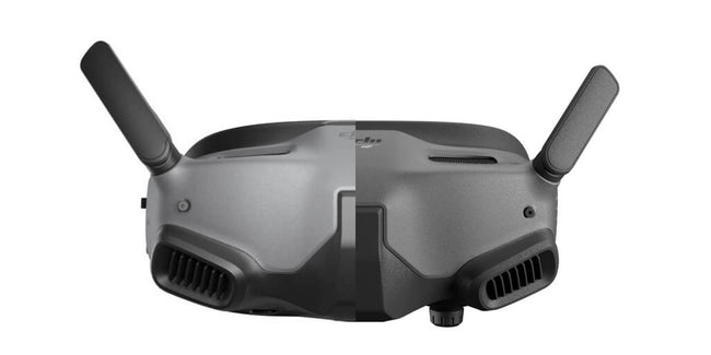
DJI's latest FPV Goggles, DJI Goggles Integra replace the still popular and available DJI Goggles 2 adding a new feature,...

Mini 2 SE vs DJI Mini 2 & DJI Mini SE: differences and changes


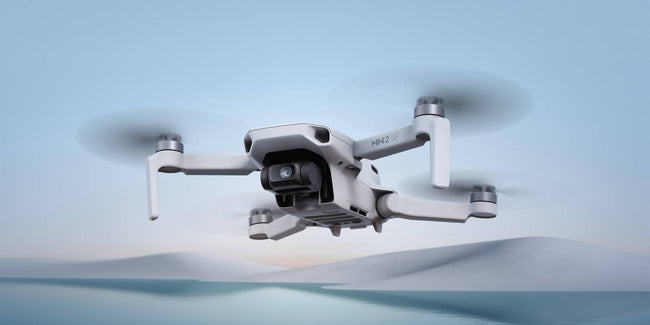
DJI recently released the DJI Mini 2 SE, its second-generation mini SE drone on the market. With DJI having a number of...

2022 Christmas buying guide: drones to put under the tree


Christmas is nearing and it's time to start looking the perfecto drone to buy friends or family, especially with increase in delivery times and...